Historical Maps
Dublin Core
Title
Historical Maps
Description
Historical Maps used for the European Postcards map, Southern Ontario Postcards map, Niagara Peninsula Postcards map, and Maps of Postcard Stamp Locations exhibit.
Collection Items
Niagara Peninsula Map 1910
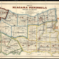
A Map of The Niagara Peninsula in Southern Ontario, Canada made in 1910 sourced from the Map, Data, and GIS Library at Brock University in St. Catharines, Ontario
Preston, Southport, and Blackpool Map 1920
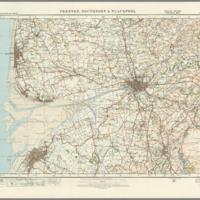
A map of Preston, Southport, and Blackpool in England made in 1920 sourced from the David Rumsey Map Collection online
Southern Ontario 1915
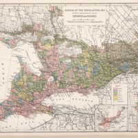
Population map of Southern Ontario, Canada made in 1915 sourced from the David Rumsey Map Collection online
World Atlas Map 1911
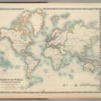
A World Atlas Map made in 1911 sourced from the David Rumsey Map Collection online